Is It Possible to Use Google Earth's Topographic Data in SketchUp?
·2 min read

Learn how to create terrain based on Google Earth's topography
This tutorial shows how to make use of Google Earth's topographic data using only SketchUp. Go to the menu File/Geo-location-Add Location. NOTE: Another way to set a location is through the menu View/Toolbars (View/Toolbars) – Google;
First, click the toolbar button to add the location.
Type the address of the location and click Search (Search).
Adjust the positioning as you like, then click Select Region (Select Region). Adjust the area to be captured and click Grab (Grab).
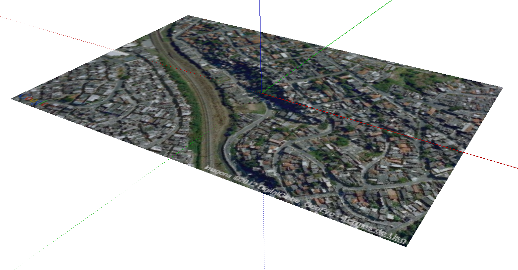
 NOTE: The closer you are, the better the image quality will be; if you want to capture a very large area, you'll need to take more than one capture.
Great, we've located our project; now we need to activate the elevation. To do this, click Toggle Terrain (Toggle terrain), the second button in the Google toolbar.
NOTE: The closer you are, the better the image quality will be; if you want to capture a very large area, you'll need to take more than one capture.
Great, we've located our project; now we need to activate the elevation. To do this, click Toggle Terrain (Toggle terrain), the second button in the Google toolbar.

 Notice that the image has changed and now shows several raised surfaces.
Select the terrain and notice that the selection box appears in red, because the object is locked.
To unlock the terrain, right-click and select the Unlock (Unlock) option.
Draw a rectangle larger than the terrain and position it below it. Select the Move (Move) tool with Ctrl active to duplicate the face at the desired distance for each contour line you want to obtain. In the example, the rectangles were copied 5m apart in height.
Notice that the image has changed and now shows several raised surfaces.
Select the terrain and notice that the selection box appears in red, because the object is locked.
To unlock the terrain, right-click and select the Unlock (Unlock) option.
Draw a rectangle larger than the terrain and position it below it. Select the Move (Move) tool with Ctrl active to duplicate the face at the desired distance for each contour line you want to obtain. In the example, the rectangles were copied 5m apart in height.
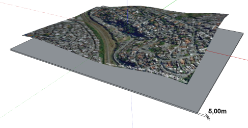
 Make sure the terrain is completely covered by the rectangles; if you like, turn on X-ray (X-ray) and check that the terrain is in the middle of the rectangles. Select all the rectangles and the terrain, right-click, and select the Intersect Faces/With Selection (Intersect faces/with selection) option.
 Delete the rectangles, but be careful not to select the image and the newly created contour lines. Turn off the Google Earth Terrain layer (created when you imported the terrain) and notice that only the created contour lines remain visible. Create a new layer for the contour lines.
Select all the contour lines and go to the menu Draw/Sandbox/From Contours (Draw/Sandbox/from contours). Turn off the contour lines layer and see how your terrain turned out. Avoid rotating or moving it so you can carry out accurate sun-study analyses, or in case you want to export your project in the correct location for use in another program in the future.
Delete the rectangles, but be careful not to select the image and the newly created contour lines. Turn off the Google Earth Terrain layer (created when you imported the terrain) and notice that only the created contour lines remain visible. Create a new layer for the contour lines.
Select all the contour lines and go to the menu Draw/Sandbox/From Contours (Draw/Sandbox/from contours). Turn off the contour lines layer and see how your terrain turned out. Avoid rotating or moving it so you can carry out accurate sun-study analyses, or in case you want to export your project in the correct location for use in another program in the future.
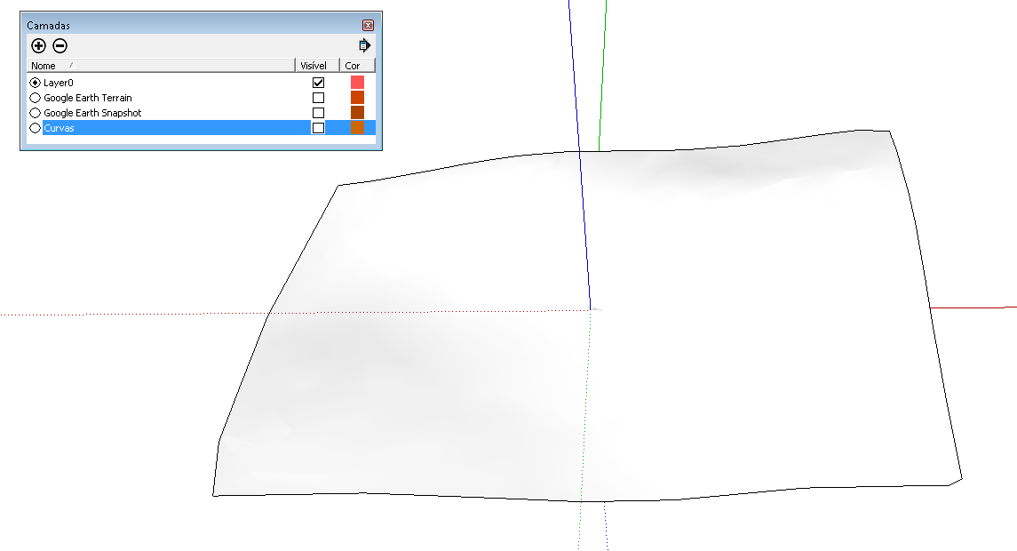 Notice that your terrain is correctly geolocated.
 Now that you know how to use Google Earth data in SketchUp, you might want to start by building a house to place on this terrain, and then the question comes up: "how do I level the house's entrance with the terrain?"...