Meet PlaceMaker, a 2D and 3D urban infrastructure data capture system for SketchUp
SketchUp version 8 was released by Google in 2010, and users had the opportunity, for the first time, to capture geolocated aerial imagery for their work. As everyone knows, in 2012 SketchUp was sold to Trimble, a large American corporation traditionally known for its navigation and geopositioning systems.
Trimble continued offering geolocated image capture for SketchUp Pro users. Currently, it's possible to import low-resolution images for free, and to download high-quality images, you need to pay extra.
Without a doubt, importing images through SketchUp Pro's native tool is great, but if you need street layouts, railways, subways, bodies of water, trees, or buildings already modeled in 3D as massing, what's the solution?
That's where PlaceMaker comes in. This plug-in works as an integrated system for importing georeferenced data into SketchUp, and is produced by Mind Sight Studios, which has been developing tools for SketchUp since 2005. A version for Revit was recently released, but in this post we'll focus on the SketchUp version.
What does PlaceMaker do?
PlaceMaker is a plug-in that connects SketchUp to several urban infrastructure databases developed by companies: CESIUM ion, Mapbox, Nearmap, Microsoft and Ecopia, plus the open OSM (OpenStreetMap) database.
This way, PlaceMaker makes it easy to import aerial imagery, 3D-modeled terrain, 3D buildings (with or without textures), road and rail systems, paths and pedestrian crossings, bodies of water, and vegetation. The system also offers a premium service for more precise data, developed by Ecopia, called SmartSite.
Installing PlaceMaker is free and can be done from the manufacturer's website: https://www.suplacemaker.com/sketchup-placemaker/. From there, you can import whatever data you want, but you need to pay to actually run the import. At the time this post was published, Mind Sight Studio offered subscription (subscription) and pay-as-you-go credit purchase options. It's worth noting that, even under the subscription model, some information is still billed separately, though the rates charged are lower than for those without a subscription. For the tests presented below, the pay-as-you-go version was used, with a minimum purchase of 100 credits, which cost US$15.00.
Testing PlaceMaker
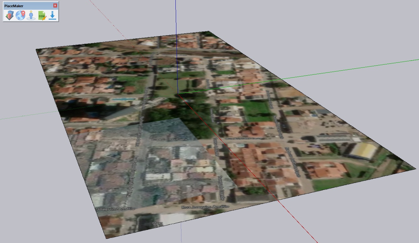
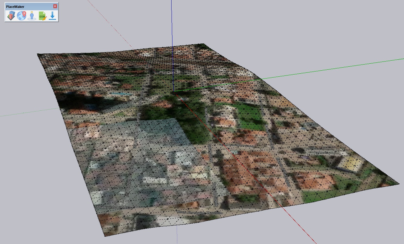
Once installed, the PlaceMaker toolbar appears on screen, as shown in Figure 1. The first step is to click the second button, called Create Geo-surface. You'll import a geolocated aerial image through the PlaceMaker system. The result is a flat image, as shown in Figure 2
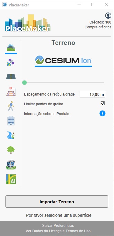
From there, you can import, through the PlaceMaker window (Figure 3), the following types of information:
- 3D Terrain: images and 3D geometry are provided by the company CESIUM ion.
- High-resolution imagery: provided by Mapbox or Nearmap. As of this post's publication, there was no high-resolution imagery available for Brazil.
- Streets (road system): data is captured from the open OpenStreetMap database. Road availability, therefore, depends on the data existing in OSM, meaning if the road system isn't modeled in OSM, PlaceMaker won't import anything, and no credits will be deducted.
- Railways (rail and subway systems): this information also comes from the OpenStreetMap database.
- Paths (bike lanes and pedestrian crossings): information and availability from the OpenStreetMap database.
- Buildings: you can choose between the OpenStreetMap database and the Microsoft database.
- Water: bodies of water are imported from the database
- 3D Terrain: images and 3D geometry are provided by the company CESIUM ion.
- High-resolution imagery: provided by Mapbox or Nearmap. As of this post's publication, there was no high-resolution imagery available for Brazil.
- Streets (road system): data is captured from the open OpenStreetMap database. Road availability, therefore, depends on the data existing in OSM, meaning if the road system isn't modeled in OSM, PlaceMaker won't import anything, and no credits will be deducted.
- Railways (rail and subway systems): this information also comes from the OpenStreetMap database.
- Paths (bike lanes and pedestrian crossings): information and availability from the OpenStreetMap database.
- Buildings: you can choose between the OpenStreetMap database and the Microsoft database.
- Water: bodies of water are imported from the OpenStreetMap database.
- Trees: also imported from OpenStreetMap and, like all the other information that can be brought in from OSM, subject to availability in that database.
- 3D Mesh (textured buildings): the Nearmap service offers, for the USA, Canada and Australia, externally modeled and textured buildings, ready to use with V-Ray or Thea Render.
- Smart terrain: the high-precision, AI-intensive scanning service is provided by the company Ecopia. Actually, this is a service that isn't directly integrated with PlaceMaker. There's a minimum area of 4 km² to place an order, and the cost is around US$ 400. The work takes a few days to complete, and you get back a highly precise, information-rich digital model.
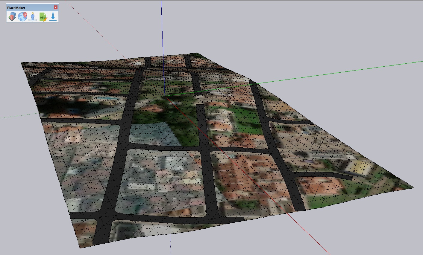
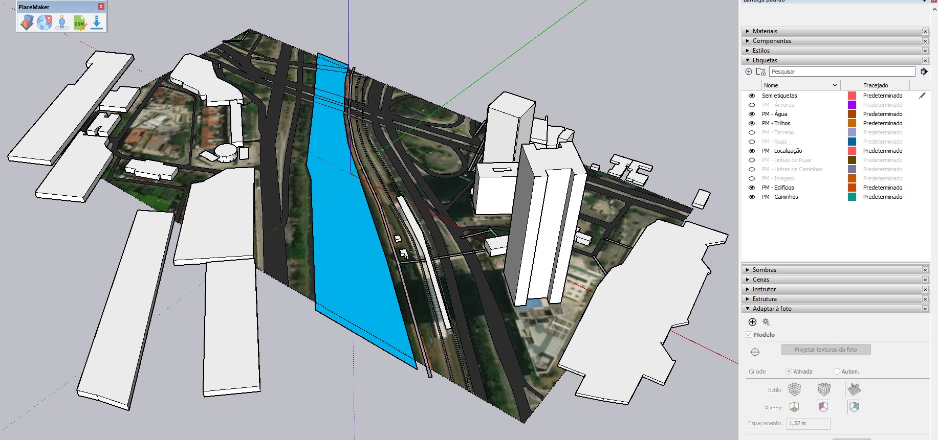
See below some of the results obtained with PlaceMaker:
Conclusion
PlaceMaker is a very interesting and agile solution for quickly and easily obtaining geometric data on urban infrastructure from virtually anywhere in the world.
The interface is quite practical and the prices are affordable for those who work professionally with urban planning, landscape planning, transportation systems, or even real estate developments of any size.
All elements come classified with easy-to-understand tags, but they're imported as groups (not as components), which makes it harder to identify objects when using the model's analytical structure, shown in the Outliner (Outliner) window.
Either way, PlaceMaker is a very interesting system for designers, developers, builders, and public- or private-sector managers, since the data obtained, with precision and speed, can be seen as important resources to support a wide range of decision-making.